


EUDR
Deforestation and forest degradation contribute to climate change and biodiversity loss. To reduce the contribution of European consumption to these impacts, the European Union adopted the EU Deforestation Regulation (EUDR) – Regulation (EU) 2023/1115.
For the timber sector, the EUDR replaces the EU Timber Regulation (EUTR) and introduces broader requirements. In addition to legality, it notably establishes requirements relating to deforestation and forest degradation, geolocation of plots of land, traceability and due diligence.
The Regulation was amended in December 2025, notably to simplify the obligations of downstream actors and introduce a specific regime for micro and small primary operators.
When does the EUDR apply?
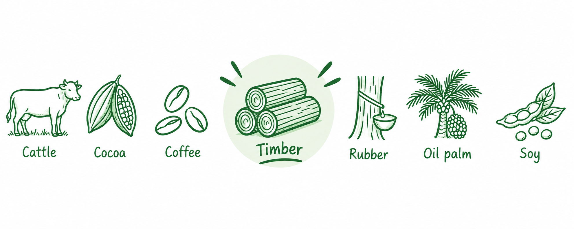
Is my product covered?
Practical tip: identify your product’s customs code and check whether it is listed in Annex I of the Regulation
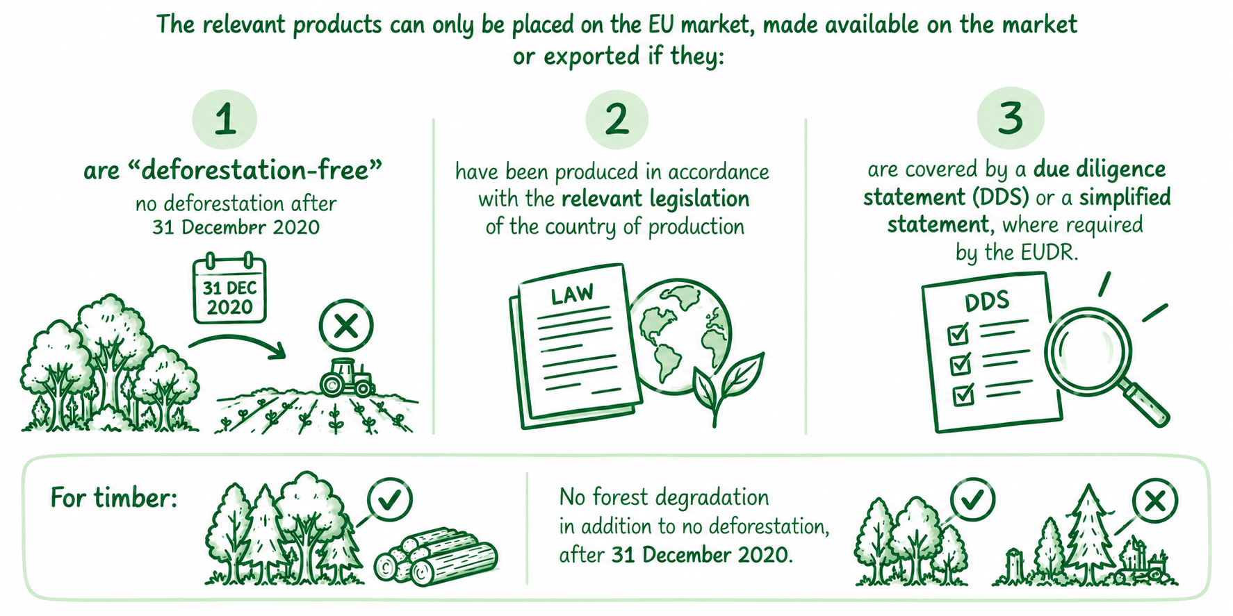
Three essential requirements
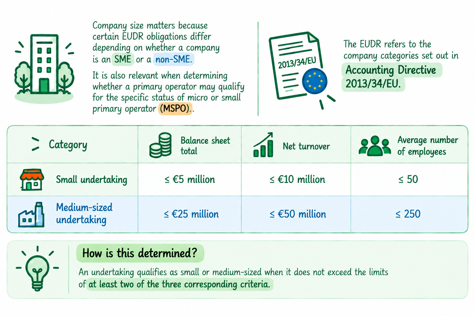
What is the size of your company?
 Special case: groups of companies
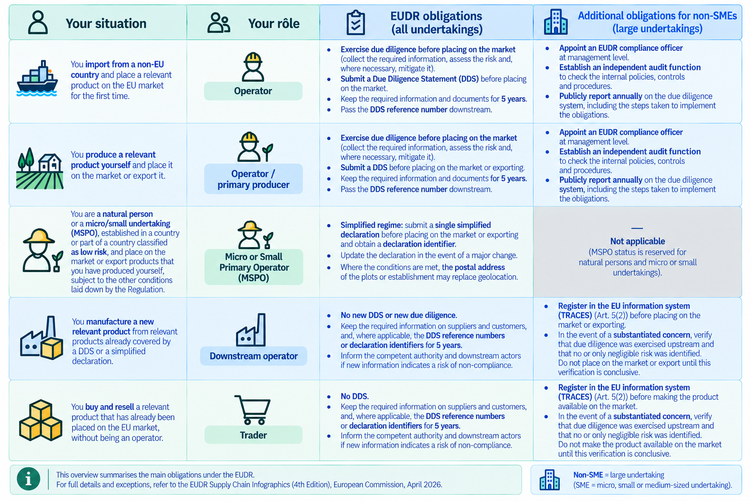
What is your role and what are your obligations?
The same company may have different roles depending on the activities it carries out. Its role must therefore be determined for each product and each transaction.
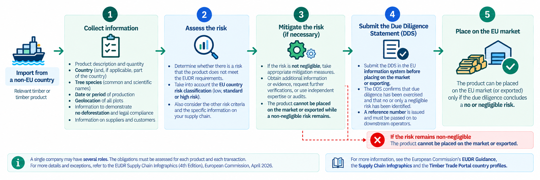
How to exercise due diligence?
Useful tools for plot geolocation
Different free and open-source tools can support the collection, preparation and analysis of geolocation data. The appropriate tool depends on your specific needs.
Need to collect plot coordinates? — Ground or KoboToolbox
These tools enable field teams to register producers and geolocate their plots using a mobile phone, including GPS points, plot boundaries (polygons), photos and other information.
They can be used offline in the field and synchronised once an internet connection is available. The data can then be exported, including in GeoJSON format.
Need to check or correct your geolocation files? — GeoRoots
GeoRoots can be used to prepare and clean geographic data that has already been collected: correct polygons, detect duplicates and overlaps, convert KML to GeoJSON, merge files, etc.
One important advantage is that the data is processed directly in your browser and is not sent to an external server.
→ GeoRoots
Need to analyse deforestation risk at plot level? — WHISP
WHISP uses GPS points or plot polygons to perform an analysis based on multiple public datasets on forests and land use.
The aim is to identify plots that may present a potential deforestation risk and those for which further checks may be necessary.
xx