Cameroun
Contexte général et ressources forestières du Cameroun
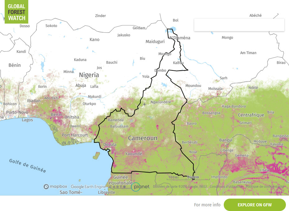
Selon le Ministère des Forêts et de la Faune (2018), le Cameroun compte environ 22 millions d'hectares de forêts, soit près de 46% de la superficie totale du pays. 26 000 hectares (0,1% de la superficie forestière) sont classés comme forêts de plantation.

Surface pays
47.3million ha
Surface forestière
20.2million ha
Forêt de production
15.7million ha
Propriété forestière
100% propriété publique
CONTEXT
According to the Ministry of Forests and Wildlife (2025) and FAO assessments (2025), Cameroon covers approximately 47.6 million hectares, of which 19.1 million hectares are forested in 2025, representing nearly 40% of the national territory.
Forest management is overwhelmingly based on natural forests under public ownership (100%), with approximately 12.1 million hectares of production forests. These include around 7.1 million hectares of Forest Management Units (FMUs/UFA), 2.35 million hectares of communal forests, and 2.59 million hectares of community forests.
The structure of the forest estate—divided between Permanent Forest Domain (PFD) and Non-Permanent Forest Domain (NPFD)—combined with varying levels of governance and control, creates significant differences in risk across supply chains.
Forest loss in Cameroon, estimated at around 117,000 hectares per year over the period 2020–2025 (FAO 2025), is mainly concentrated in the southern and eastern forest regions, particularly along agricultural frontiers and in accessible areas. It corresponds to an annual loss rate of about 0.6% of total forest cover, characterised by a diffuse and progressive dynamic driven by anthropogenic pressures, rather than large-scale industrial conversion.
This deforestation is primarily driven by:
- agricultural expansion (both industrial plantations and smallholder farming),
- fuelwood and charcoal production,
- mining activities, and
- infrastructure development.
In parallel, forest degradation and legality risks are strongly linked to:
- illegal logging and informal harvesting,
- misuse or irregular allocation of permits,
- weak law enforcement and limited administrative control, and
- corruption affecting parts of the supply chain.
In this context, operators sourcing from Cameroon must go beyond country-level indicators and conduct a robust, supply chain–specific due diligence, taking into account forest type, origin of the timber, and local risk dynamics.
RISK SCORES
|
CORRUPTION PERCEPTION INDEX (Transparency international) 26
/100 0 is highly corrupt, 100 is very clean. |
ILLEGAL DEFORESTATION AND ASSOCIATED TRADE (IDAT) Risk (Forest Trend) 91.75
/100 100 is higher risk, 0 is lower risk
|
|
SOURCING HUB RISK SCORE (Preferred by nature) 0
/100 0 is higher risk, 100 is lower risk
|
COUNTRY DEFORESTESTATION CLASSIFICATION LIST - EUDR (European Commission) Standard risk category For more information about the methodology, see here
|
Sources :
Interpretation of Risk Indicators
Subnational variations in risks
Regional and Structural Risk Considerations
Risk levels may vary significantly within producer countries. However, in Cameroon, risk assessment should not rely solely on geographic location. It must be structured around a combination of spatial, legal, and operational factors.
Cameroon-specific risk approach:
Risk is primarily determined by:
- Forest domain: Permanent Forest Domain (PFD) vs Non-Permanent Forest Domain (NPFD)
- Type of harvesting title or permit
- Level of governance and effective control
Risk interpretation by forest domain:
- Permanent Forest Domain (PFD) (e.g. industrial concessions / FMUs):
– More structured regulatory framework
– Availability of management plans and documentation
– Remaining risks: allocation of titles, compliance with management plans, social and environmental obligations - Non-Permanent Forest Domain (NPFD) (e.g. community forests, small-scale permits, unclassified areas):
– Higher overall risk profile
– Limited planning and weaker traceability
– Higher exposure to land-use change and conversion
– Often limited administrative oversight - Implications for due diligence:
• Do not rely solely on country or regional risk classification
• Assess risk at supply chain level (from plot to export)
• Verify consistency of documents across the supply chain
• Prioritise supply chains with stronger traceability and third-party verification where relevant
• Apply enhanced scrutiny for supplies from NPFD or high-pressure areas
Important:
The presence of official documents does not, by itself, guarantee legality. Compliance must be demonstrated through a coherent and verifiable set of information covering the entire supply chain.
Sources:
• FAO, Global Forest Resources Assessment 2025 – Cameroon
• FAO, forest domain structure and land-use classifications (Permanent vs Non-Permanent Forest Domain, pp. 15–27)
• Preferred by Nature, Timber Legality Risk Assessment – Cameroon (2021)
• TRAFFIC & FODER (2025), Guide to verify the legality of timber from Cameroon
| Region / Province | Forest Type | Dominant Forest Domain | Main Pressures | Key Points of Attention |
|---|---|---|---|---|
| East Region | Dense humid evergreen forest Dense humid semi-deciduous forest Gallery forests and savannas |
Permanent Forest Domain (FMUs/UFA) + Non-Permanent Forest Domain | Mining Infrastructure Agriculture |
Key production region. Verify consistency between SIGIF data and on-the-ground reality, legality of harvesting titles (corruption risk), and compliance with management plans. High risk in NPFD (small-scale permits, community forests). |
| South Region | Dense humid semi-deciduous forest Dense humid evergreen forest |
PFD + NPFD | Agriculture Mining Infrastructure |
Area under strong land pressure and conversion. Verify origin of timber (PFD vs NPFD), compliance with environmental and social obligations, and absence of post-2020 land conversion. |
| Centre Region | Dense humid semi-deciduous forest Dense humid evergreen forest Gallery forests and savannas |
Predominantly NPFD | Agriculture Infrastructure Urbanisation |
High risk due to mixing of formal and informal supply chains. Particular attention to traceability, actual origin, and document consistency. Strong urban pressure. |
| Littoral Region | Dense humid semi-deciduous forest Dense humid evergreen forest Mangrove forests |
Mixed (primarily NPFD and processing/export hubs) | Agriculture Infrastructure Urbanisation |
Risk concentrated in export chains: verify consistency of documents (species, volumes, origin), risk of document fraud and mixing of supply flows. |
| South-West Region | Dense humid evergreen forest Montane forest |
PFD + NPFD | Agriculture Infrastructure Urbanisation |
Risk varies depending on accessibility and control. Attention required for community forests and NPFD permits. Administrative control may be limited. |
Carte Global Forest Watch